
Research Areas
.")
 activ,
 sleeping,
 finished
Northern of the Lake Brienz (in collaboration with and under coordination of the HRH)
-
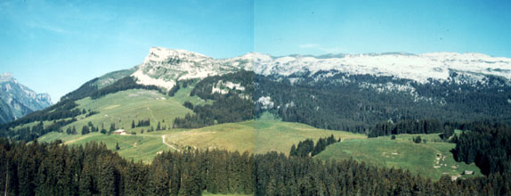
The Schrattenflue (map, No. 1) is the largest connected karren field of Switzerland. A tracer test in 1970 revealed that the water of the Schrattenflue occurred in the two sources Bätterich and Gelber Brunnen (map, No. 4) in the 21 km distant lake Thun after very short time. The exploration of this region is coordinated by the HRH (Speleological Association Region Hohgant)/ GES/GHS (Group Exploration Schrattenflue). In the past, we had been actively working as an individual group within the HRH in the area of the Schrattenflue. The largest object of our research was the Neuenburger Cave with more than 8500 m length and many open ends.
The region Entlebuch is a UNESCO Nature Reserve. These region was the first UNESCO Nature Reserve of Switzerland. The Schrattenflue lies in the core zone of this nature reserve.
- Bärenschacht
-
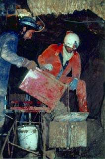
Between 1988 and 2005 we have been digging in the Akkordloch (map, No. 3), a cave underneath the village Beatenberg. Most likely, this cave was (similar to nearby Laubloch) an old drain of the Bärenschacht System. The entrance of the Bärenschacht cave is located at the Beatenberg at 1500 m NN. In August 1986, the 56 m long end siphon could be defeated by diving. Behind the siphon, more than 80 km spacious galleries have been discovered and explored, reaching down to the level of the lake Thun (558 m NN). The last discoveries have shown that a connection with the huge Réseau Sieben Hengste (140 km, −1340 m) is very likely. The hope to find an entrance into the Bärenschacht cave behind the siphon was the motivation to dig more than 100 m into the Akkordloch. In this region, we are working closely with and under the coordination of the HRH (Speleological Association Region Hohgant).
- Gelber Brunnen/ Bätterich
This karst region begins at the Schynige Platte, above Interlaken, and reaches more than 20 km until Meiringen. The highest cave entrances are located at 2400 m NN, the sources at Meiringen are located at 600 m NN. The deepest and longest object in this area is the Oberländer cave in the Sägistal, a cave system with two entrances. Up to now, this cave has been explored down to a depth of over 450 m and a length of more than 1.6 km. Further larger caves with more than 1000 m length are yet awaiting further exploration of open continuations.
- Sägistal
- Gstepf/ Harzisboden
- Giessbachtal, Botchen
- Axalp
- Brunnenflue
Others
- Klufthöhle Hasliberg
-
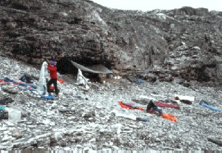
This karst region eastern of Meiringen was completely unexplored until 1992 (map, No. 11). Compared to other known karst areas of the Bernese Oberland, it consists of quite mighty sediment layers, nurturing the hope of deep cave pits. This area is located between 2200 and 3000 m NN, therefore, the season for cave research is quite short. During the first ISAAK research weekend in the Tällistock region in 1993, a pit of more than 100 m depth was discovered.
- Kosovo 2000
- Caucasus